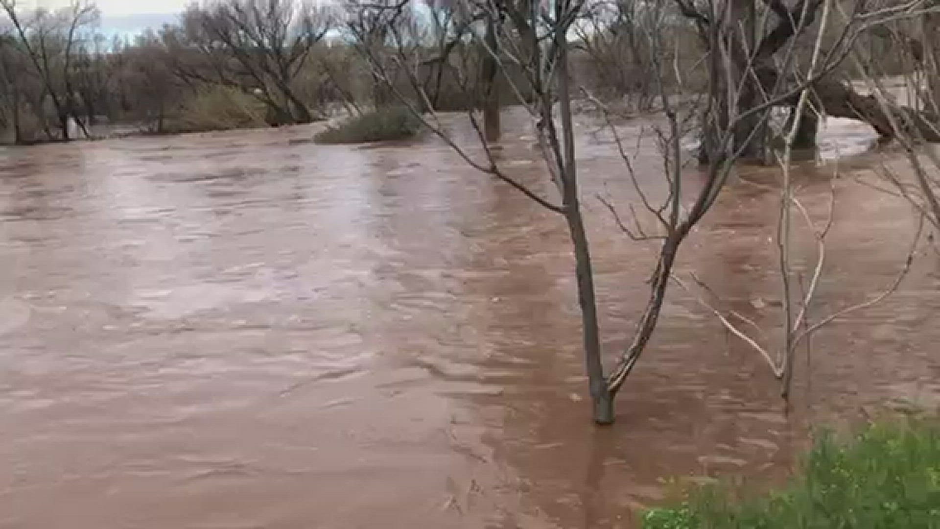
PHOENIX — Heavy rainfall in northern Arizona combined with snow-melt has caused multiple rivers and washes to swell over their banks. Here's a look at the hour-by-hour changes in the water level recorded by the United States Geological Survey (USGS).
Evacuations are currently in place for Sedona, Cottonwood, and Camp Verde residents near the Verde River as water levels continue to rise.
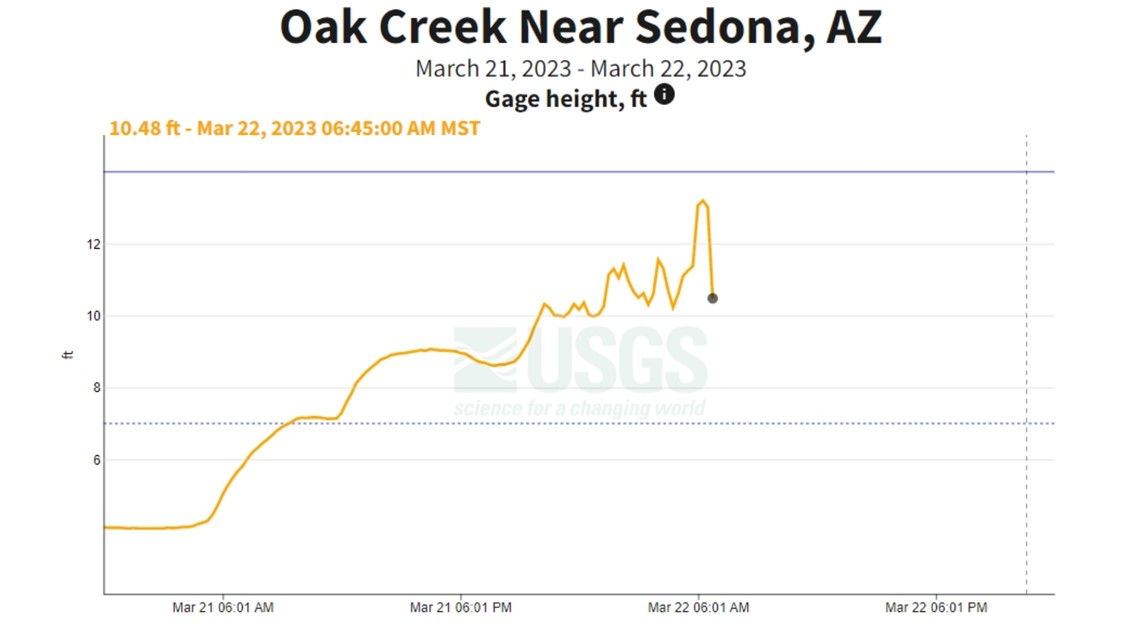
Rainfall started in the High Country Tuesday evening, causing the water level in Oak Creek near Sedona to start rising. Around 10 p.m. on Tuesday, the water was roughly 10 feet deep.
That number spiked into Wednesday morning, and the USGS recorded a depth of 13.2 feet at 6:15 a.m. Water levels rose nine feet in just 12 hours.

>>RELATED: Los ríos de Arizona se inundaron el miércoles: Así se vieron los niveles de agua por hora
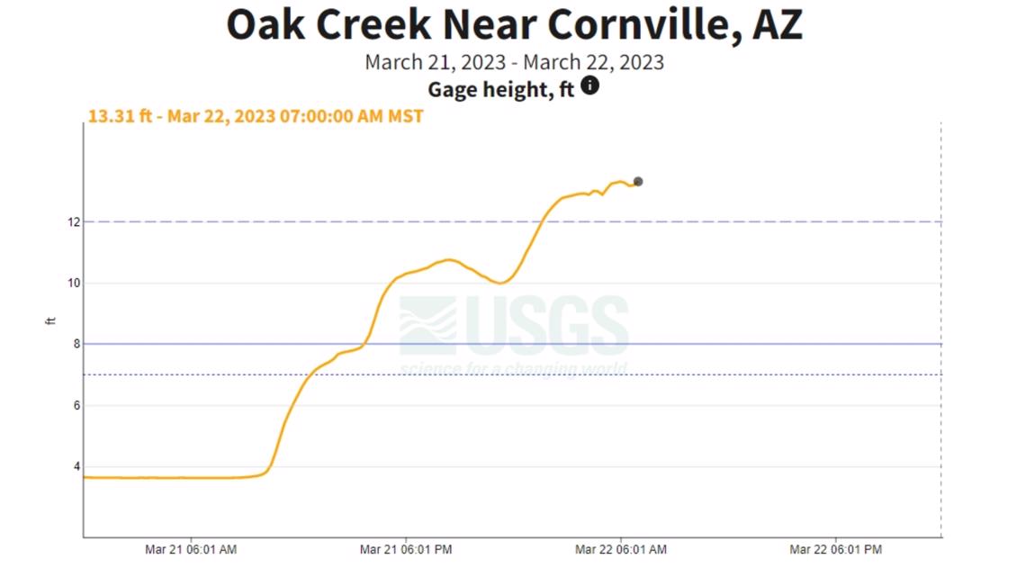
Further down Oak Creek near Cornville, water levels saw a more gradual climb as the area received flow from further upriver. The water depth was 12.12 feet at 1:45 a.m. and has continued to climb to 13.31 feet as of 7 a.m.

Around 7 a.m., the Yavapai County Sheriff's Office put out an evacuation alert for the Cottonwood area on the Verde River, and shared the following photo to their Facebook page:

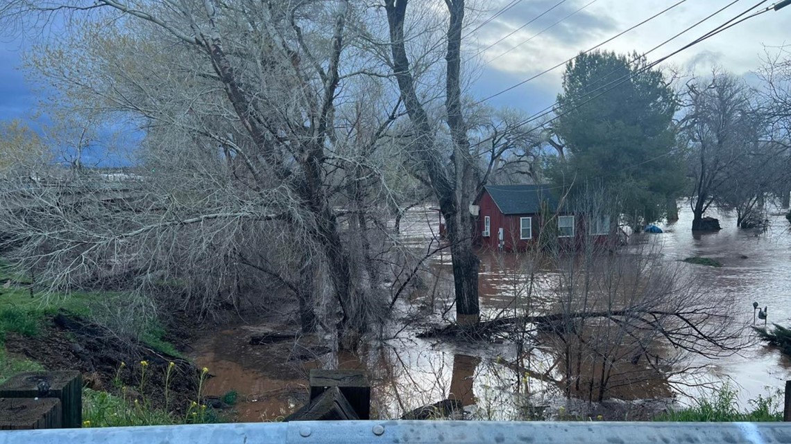
The photo, taken from a roadway, shows the Verde River high enough to flood a nearby home and submerge several trees in the area.
At this point, water in the nearby Cave Creek was recorded as deep as 7.79 feet, well above the area's typical 3-foot to 4-foot depth.
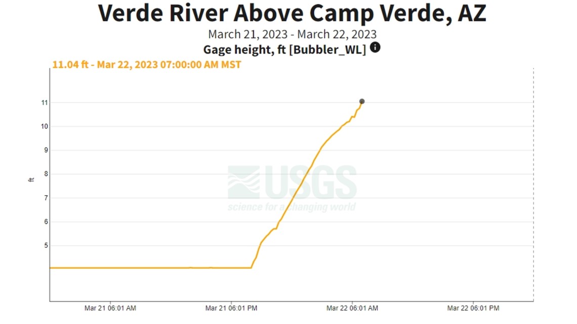
Near Camp Verde, water levels have been on a steady climb since 8:15 p.m. on Tuesday. Over the last 12 hours, the water level has climbed to 11.04 feet.

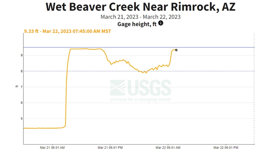
Meanwhile, Wet Beaver Creek has been living up to its name and saw water levels shoot up from 4.4 feet to 9.4 between 8 a.m. and 10 a.m. on Tuesday. Following a slight dip down to roughly 8 feet overnight, the water level has since crept back up to 9.36 feet with Wednesday morning's rain.

Just north of the area, Dry Beaver Creek has seen water levels rise and fall more sporadically.

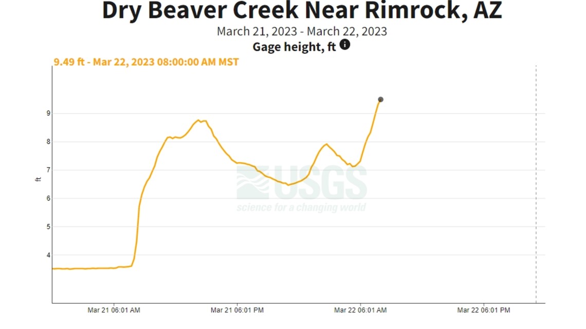
Tuesday night's rain brought water levels as high as 8.76 feet before the area saw some drainage. Another rush of water raised the depth to 7.91 feet around 2:30 a.m. on Wednesday. Finally continued flow into the area has the water level climbing, and it was recorded as 9.49 feet deep at 8 a.m.
Finally, the water level of the Verde River near Camp Verde is on the rise as flow from upriver continues to pour into the area.

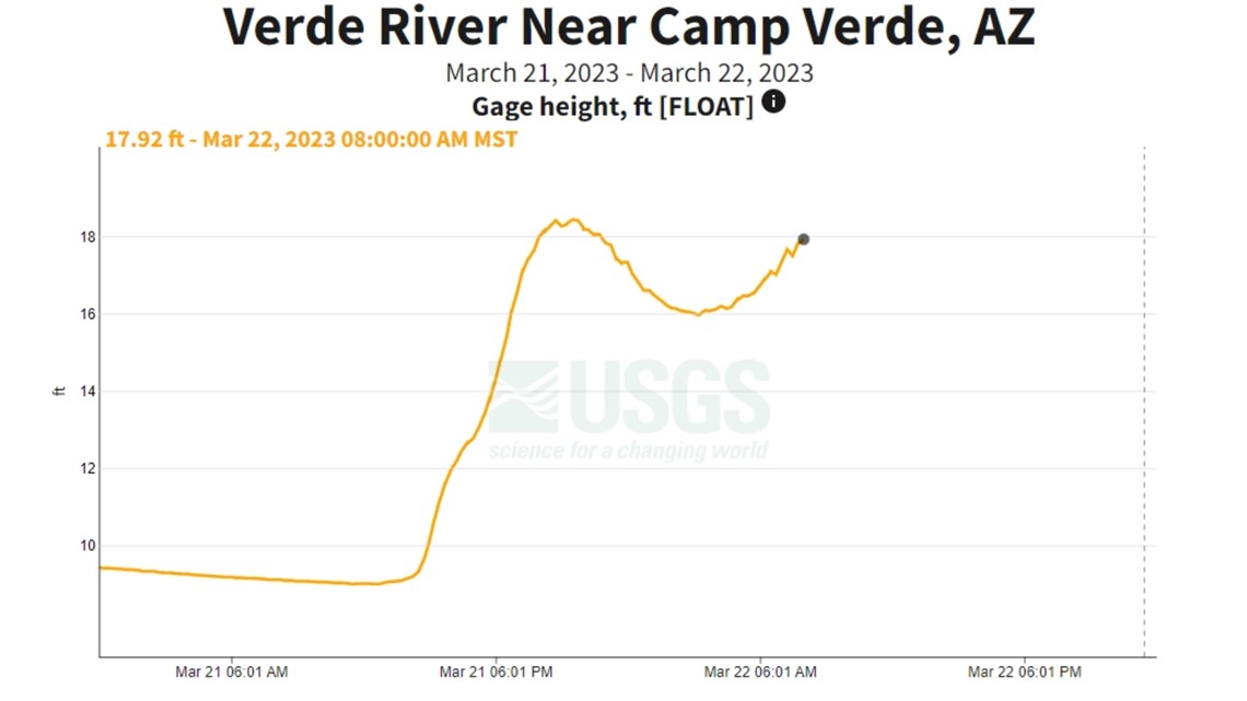
Water levels climbed to 18.41 feet just before 10 p.m. Tuesday night, and saw a slight decrease to 16 feet overnight. However, Wednesday morning's rain means that the water level is rising once again and was last recorded at 17.92 feet at 8 a.m.
It's a massive jump from the Verde River's level of around 9 feet early Tuesday morning, and the water level is likely to climb even higher through the morning.
The data even shows when dams time water releases to maintain reservoir levels. At the Horseshoe Reservoir, water levels have been on a steady decline due to a scheduled release, but you can see when more of the flow control barriers were opened due to the flooding.

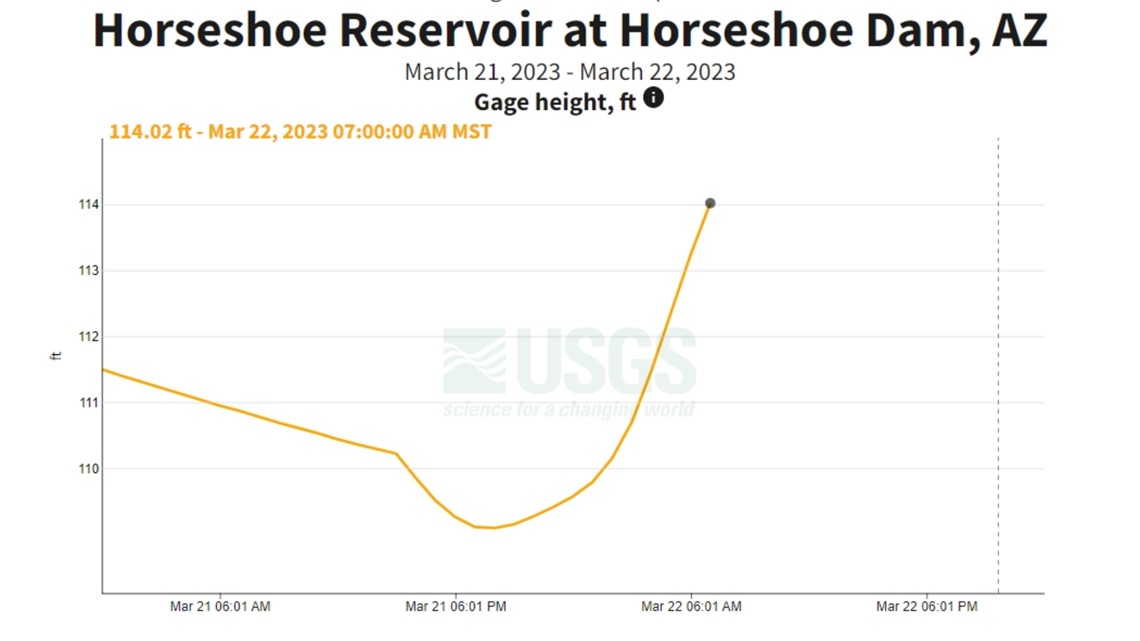
Water levels plummet around 3 p.m. on Tuesday, but have begun to climb again Wednesday morning as the weather picks up.
So where is all this water coming from?
Data provided by the Maricopa County Flood Control District shows the heavy rainfall in the High Country that filled up the rivers upstream from us.

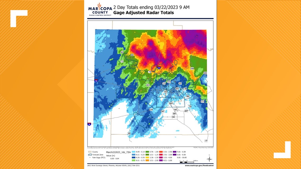
The storm totals since Monday overnight chart 2-5 inches of rain to the north and east of Phoenix along the borders of Gila and Yavapai counties, the district explained.
All of those streams and washes flow south-by-southwest into the Valley.
You can click here to track USGS water data online.
Stay with 12News as we continue to bring you the latest on Arizona's weather.
Arizona Weather
Drought, wildfires, heat and monsoon storms: Arizona has seen its fair share of severe weather. Learn everything you need to know about the Grand Canyon State's ever-changing forecasts here.

