
After a busy monsoon day across Arizona Sunday, storms continued overnight into Monday.
Recall tips on lightning safety, flash flooding, and driving when a dust storm hits.
MONDAY
6:16 a.m.
NWS in Tucson said southern Arizona can expect scattered storms to start early this afternoon and continue through tonight.
5:46 a.m.
NWS Phoenix says Valley commuters are seeing a few light showers "hanging around," which "should clear soon." T-storm chances a possible again later today.
5:36 a.m.
Still no measurable precipitation in Phoenix.
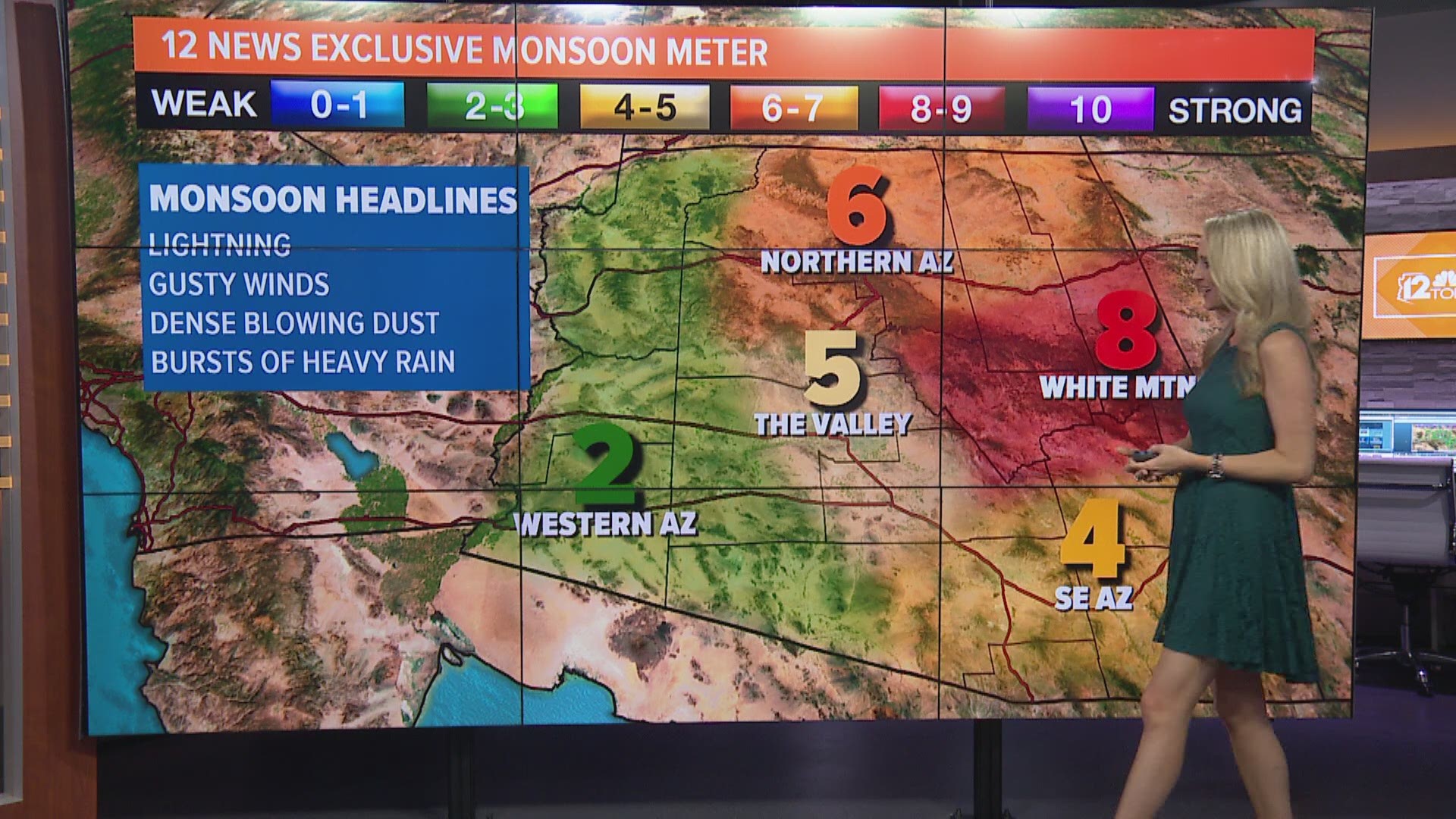
On the 12 News Exclusive Monsoon Meter, the Valley was at a 5 for Monday while the High Country showed a 6. Storm chances are in the forecast all week long.
4:40 a.m.
MCDOT says SR 238 is closed between SR 85 and MP 24 during to running washes.
4:19 a.m.
APS says there are about 15,000 people without power in the Buckeye and Southwest Valley near Gila River.
3 a.m.
NWS in Phoenix said the "big winner" in Maricopa County when it came to overnight rain totals was SR 238 between Maricopa and Gila Bend. Over 1.5 inches of rain was recorded there.
Sunday
10:00 p.m.
Interstate 10 is back open, but the dust storm that shut down parts of the highway continues to head north and west, NWS said. Activity will continue through overnight.
9:30 p.m.
Interstate 10 is closed near Casa Grande due to a large dust storm. Eastbound traffic is stopped near State Route 187 and westbound traffic is stopped near Interstate 8, ADOT says.
7:41 p.m.
Meteorologist Reed Timmer said a substantial flash flood is growing in size in Oro Valley. He posted a video to Twitter.
6:00 p.m.
NWS Phoenix said there is a flash flood warning in effect until 7:45 p.m. Sunday near Wickenburg.
3:30 p.m.
Strong winds, thunder and lightning started making it's way to Bartlett and Horseshoe lakes, NWS Phoenix said.
3:00 p.m.
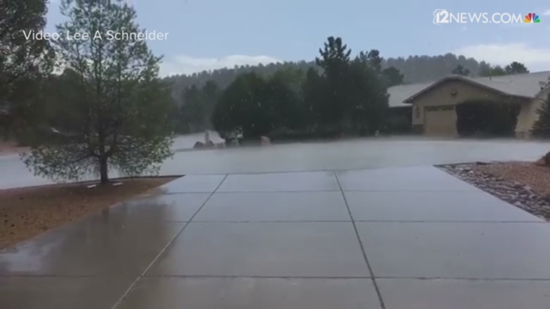
12 News Weather Watcher Lee A Schneider caught video of a quick downpour in Payson. He said the temperature dropped from 95 degrees t 74 degrees in 30 minutes.
2:10 p.m.
NWS Tucson said a shower developed over northwest Tucson, and was moving southwest.
2:05 p.m.
Thunderstorms approaching Prescott and Prescott Valley metro regions. NWS says to expect gusty winds and heavy rain. This thunderstorm is moving east to west.
1:06 p.m.
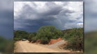
Skies grew dark in Oak Creek. This photo is from 12 News producer and Weather Watcher Stacey Roberts.

11:45 a.m.
Watch Trisha Hendrick's forecast here.
Share your photos with us on our Facebook page and our Twitter feed using #BeOn12.
5:00 a.m.
NWS Phoenix says strong storms are possible across central Arizona, including Casa Grande and the Phoenix metro area.
It could start Sunday afternoon and continue into the night.
Storm impacts could include strong downbursts, blowing dust and heavy rain.
Download the 12 News KPNX app for the latest Arizona weather updates, radar and more
iPhone: http://12ne.ws/iphone
Android: http://12ne.ws/android
3:44 a.m.
NWS issued a blowing dust advisory from Nogales to Phoenix from 2 p.m. to 8 p.m.