PHOENIX — A string of storms that have been battering California and the west coast will move inland and bring significant impacts to State 48 this weekend.
Storm #1 arrives: Saturday night-Sunday
Storm #2 arrives: Monday- Tuesday
>> Full forecast: 12news.com/weather

When will it start?
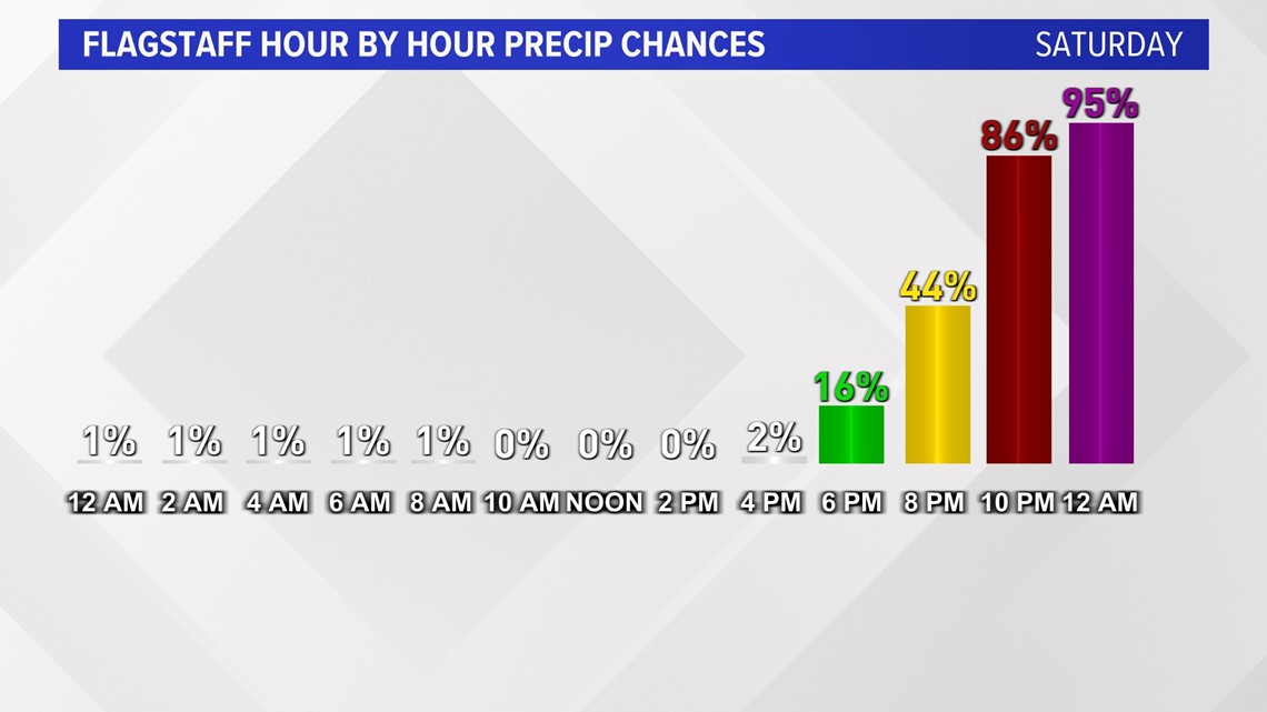
Precipitation will begin in western Arizona around 4 p.m. on Saturday. If you live closer to Flagstaff, the snow should hold off until about 8 p.m. Saturday. Rain will hold off in the Valley until around 11 p.m. and snow won't arrive in the White Mountains until after midnight. Snow levels will begin around 5,500 feet. Above that level is where we’ll see the highest snow totals over the next few days.


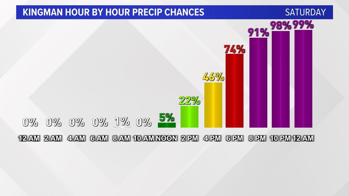
When will precipitation be the heaviest?
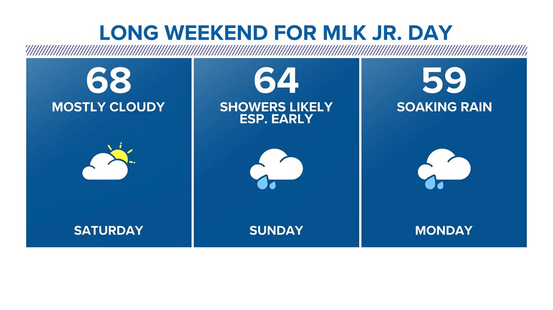
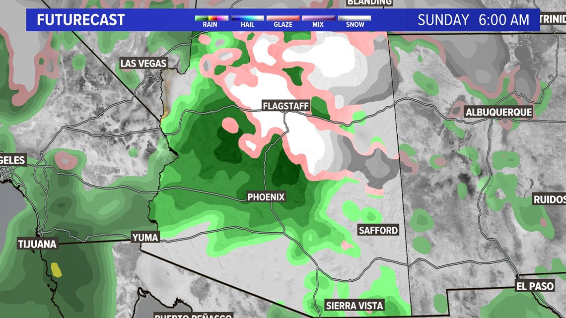
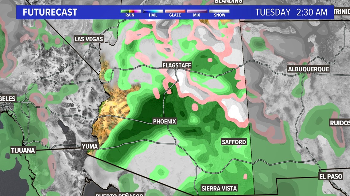
There will be two periods of heavy and steady precipitation. The first one will occur on Sunday morning. The second heavy period will be Monday evening through Tuesday morning.
In Phoenix, after some periods of heavy rain on Sunday morning, Sunday afternoon should feature some dry time. Meanwhile, up in the high country don't count on that lull in the snow for Sunday afternoon. Precipitation will be pretty persistent throughout the day.
Monday-Tuesday will be quite wet, with fewer breaks in the precipitation, even for the Valley.


How much snow will fall?
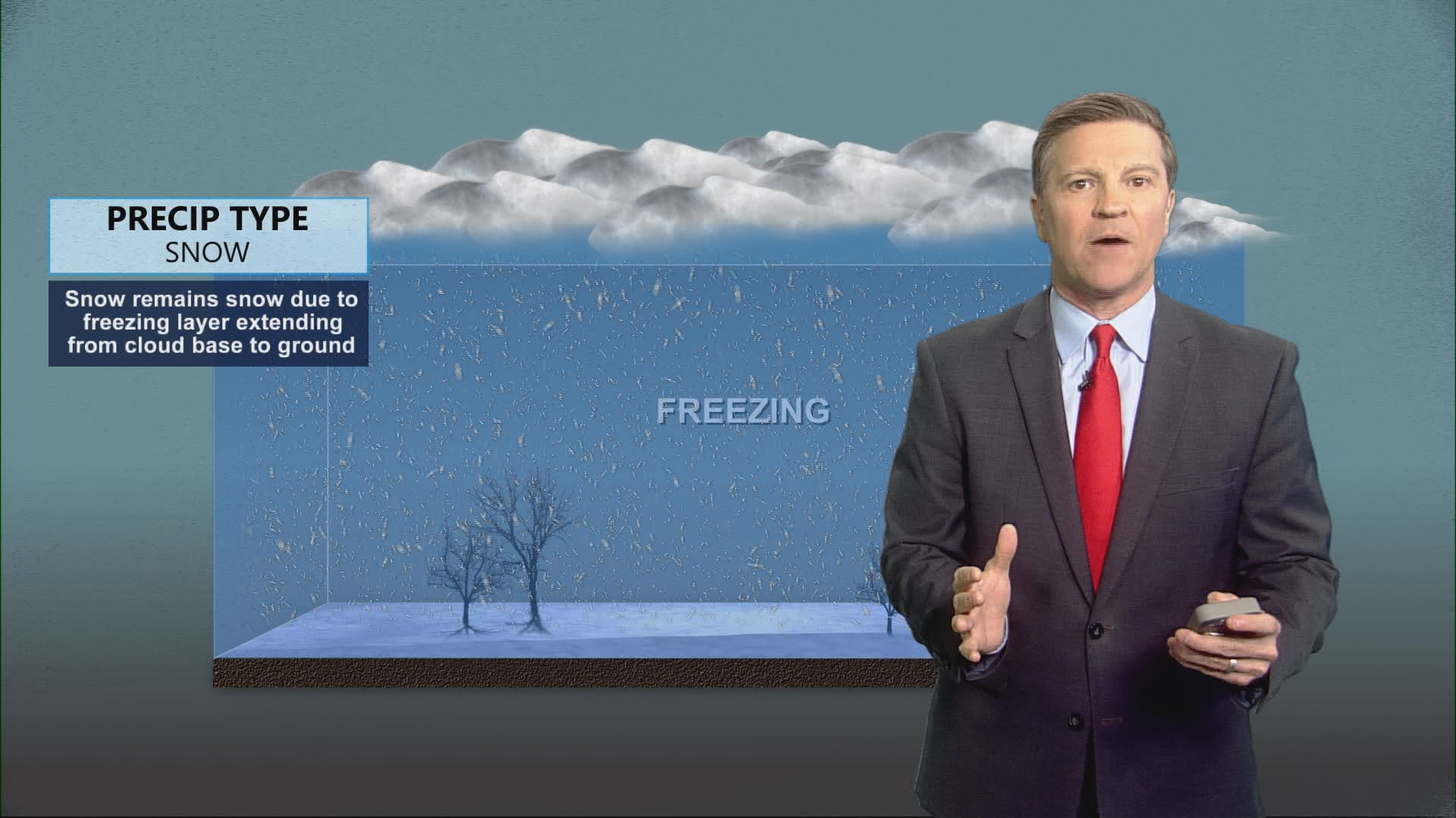
The first storm will drop 6-12" of snow between Saturday night and Sunday above 5,500 feet. The second storm has the chance to drop an additional 6-12" above 5,500 feet, but snow may be seen as low as 4,000 feet. Some of the higher mountains will see snow totals in the 2 feet plus range!

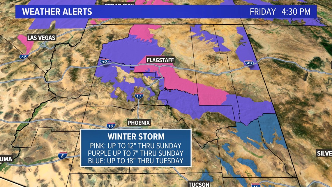
Travel
Travel will be treacherous across the high country this weekend and there may even be some road closures. Snow will begin Saturday night into Sunday. Flagstaff and surrounding areas can expect gusts around 35-40 mph while the White Mountains could see gusts up to 55 mph. Wind of this caliber will create blowing snow and white-out conditions.
Up to Speed
Catch up on the latest news and stories on the 12News YouTube channel. Subscribe today.


