ARIZONA, USA — Heavy rains, flooding and strong winds were no stranger to much of Arizona over the weekend, and the trend will continue this week.
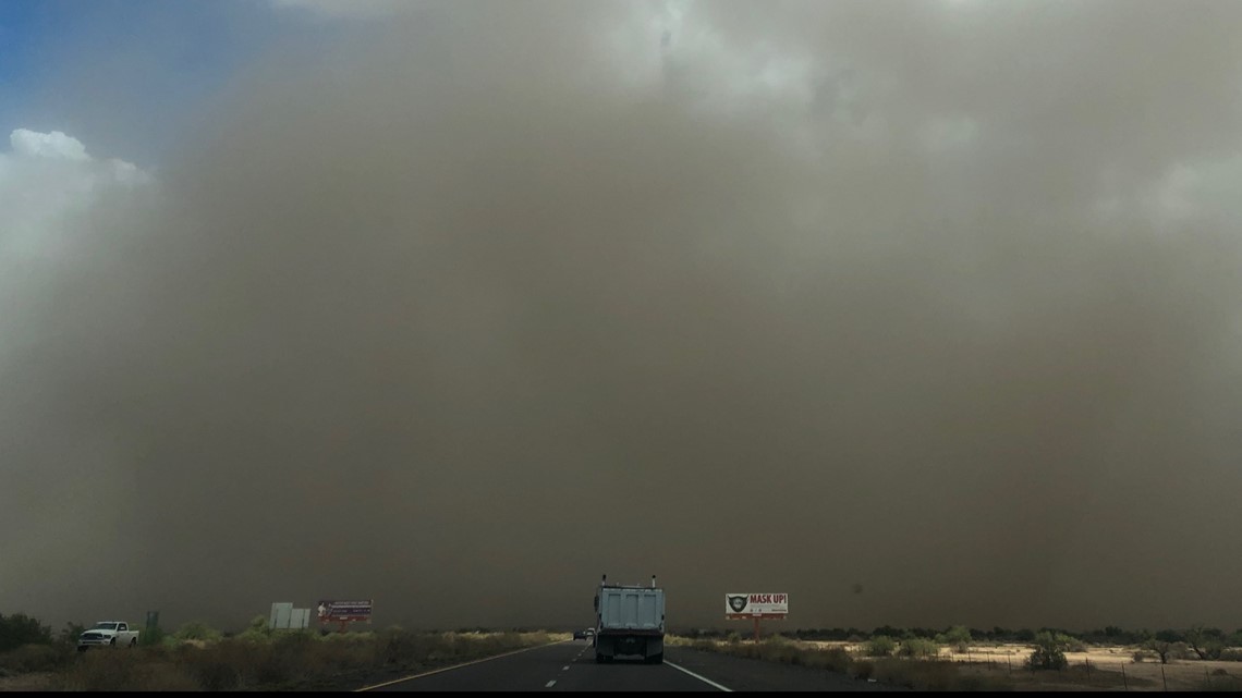
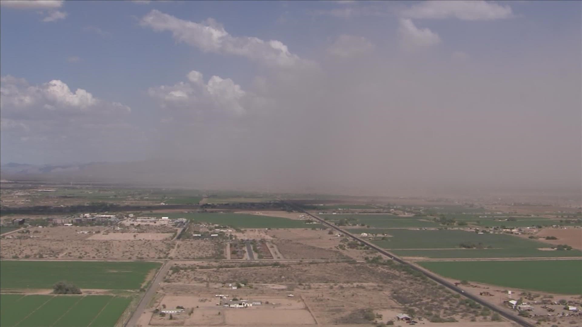
Storms have the potential to be potent and heavy rainfall-makers. This has kept a flash flood watch in effect for much of Arizona through Wednesday morning and it includes the Valley. Also watch out for lightning, strong outflow winds, blowing dust and small hail.
FORECAST: Monsoon is clocking in this workweek
Tuesday
10 p.m.:
8:45 p.m.:
7:45 p.m.:
7:05 p.m.:
6:05 p.m.:
6 p.m.:
4:30 p.m.
3:35 p.m. - A flash flood warning is effective in La Paz County until this evening.
3:30 p.m. - Flood watches in southern and northern Arizona have been extended through 5 p.m.
2:37 p.m. - Some slow-moving storms are rolling through near Tucson and Flagstaff. NWS warns they can produce flooding in some areas.
1:34 p.m.: A Flash flood warning is in effect for portions of Coconino County, including Doney Park, Timberline, Wupatki Trails, Fernwood, Pine Mountain Estates and Hutchinson Acres.
1:16 p.m.: Flash flood warning issued for portions of Yavapai County.
1 p.m.: A dust storm advisory has been issued this afternoon for areas throughout Pinal County around Interstate 10.
12:45 p.m.: A flash flood warning has been issued for parts of Yavapai County.
12:20 p.m.: Parts of Coconino and Navajo counties should be alert for severe weather including wind and heavy rainfall.
2:40 a.m.
Multiple Valley communities are under Flash Flood Warnings as monsoon rain continues to fall.
Monday
10:30 p.m.
>> Download the 12News app for the latest local breaking news straight to your phone.
9:40 p.m.:
9:30 p.m.:
9 p.m.:
8:50 p.m.:
Sky 12 video:
8:45 p.m.:
8:15 p.m.:
8 p.m.:
7:50 p.m.:
7 p.m.: A flash flood warning has been issued for part of Coconino County.
5:30 p.m.: Heavy showers are leading to ponding water on north Phoenix roads.
5:15 p.m.: Tuba City and Moenkopi are under a flash flood warning.
3:40 p.m. - NWS is reporting flooding in some areas of the state.
3:15 p.m. - Photo from 12News viewer Autumn Gardner.


2:20 p.m. - A wall of dust is moving into the Chandler area
1 p.m. - A flash flood warning has been issued for portions of Yavapai County until 4 p.m.
9:40 a.m. - Flash flood watch has been expanded north to include Flagstaff, Grand Canyon National Park, and the Glen Canyon region.
Sunday
7:52 p.m. - The dust advisory for easter Yuma County and Maricopa County has been extended.
7:12: p.m. - A dust storm advisory has been issued for the Gila Bend area.
6:35 p.m. - NWS says powerful storms are developing in southwest Maricopa County.
5:47 p.m. - A dust storm warning is in effect for I-10 in Pinal County.
5:44 p.m. - Parts of Maricopa and Pinal counties are under a thunderstorm warning.
1:28 p.m. - NWS Flagstaff has announced a flash flood warning for parts of Apache County.
Storm coverage is expected to expand in the Flagstaff area into the evening.
12:20 p.m. - Flood watch will continue through late Tuesday night into early Wednesday morning.
11:54 a.m. - NWS Tucson has announced a flash flood warning for the area around Bisbee until 1:45 p.m.
9:26 a.m. - The Arizona Department of Transportation has announced that SR-85 southbound reopened near Gila Bend.
At this time, SR-238 remains closed due to flooding between Gila Bend and Maricopa.
8:52 a.m. - DPS has announced that SR-238 is closed between MP 27-32 near Gila Bend and Mobile due to flooding in the area.
NWS Phoenix has announced a flash flood warning for areas including Gila Bend and Bosque until 11:30 a.m.
8:34 a.m. - NWS has announced a flash flood warning for parts of Maricopa County until 10:30 a.m.
8:15 a.m. - Isolated severe storms possible in areas stretching across the Phoenix metropolitan area.
7:00 a.m. - Heavy rain moving across parts of Maricopa and Pinal counties. Watch out for localized flooding in those area.
6:30 a.m. - NWS Phoenix announced a Flood Advisory for parts of South-central Arizona, including Maricopa, Pinal and Gila counties.
Saturday
7:55 p.m. - A look at earlier flooding in Flagstaff in Schultz Creek on Saturday.
4:48 p.m. - NWS Phoenix says to be on the lookout for increased storms Sunday capable of producing strong winds, heavy rain and localized flooding.
2:39 p.m. - Flood watch posted starting Sunday afternoon until Monday morning.
5:36 a.m. - Active weekend of rain ahead. NWS Tucson shares a little of what to expect.
Friday
8:29 p.m. - Chances of rain increase with the highest possibility for rain in the Valley on Sunday and Monday.
Arizona Weather
Arizona has seen its fair share of severe weather. Here is a compilation of videos from various storms across the Grand Canyon state.
Flooding Safety:
The Arizona Fire & Medical Authority has provided the following tips on what hazards to watch out for during and after a flood, including fire, electrical and chemical safety:
Generators and alternative heating devices can create fire hazards during flooding if they aren’t used correctly or maintained properly. Pools of water and appliances can become electrically charged and can cause electrical fires.
On electricity, residents in flooded areas should turn off the power to their homes if they can reach the main breaker or fuse box. All wiring in the house may be electrically charged and hazardous. Residents should have a professional technician check their home for damages before turning on the power.
Make sure potentially combustible liquids like paint thinner, lighter fluid or gasoline haven’t spilled within or near your home. Keep combustible liquids away from electrical or alternative heat sources so as to not start a fire.
All smoke alarms in the home should be tested monthly and batteries should be replaced yearly. Some smoke alarms are dependent on your home’s electrical service and may go out when power is turned off.
Make sure the fire hydrant near your home is cleared of debris so the fire department can assess it easily in the event of a fire.

