ARIZONA, USA — Following a stretch of beautiful weather that included below-average temperatures, lower humidity and sunny skies, our monsoon and the radar will get quite active this week.
Our rather tranquil weather pattern is undergoing a transformation to bring us several rounds of showers & thunderstorms throughout the work week.
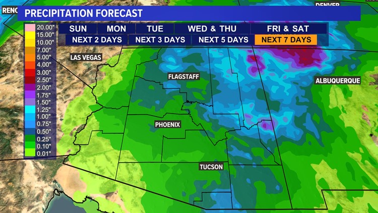
The best chance of rain for the Valley, as well as the rest of the state, will be Tuesday through Thursday.
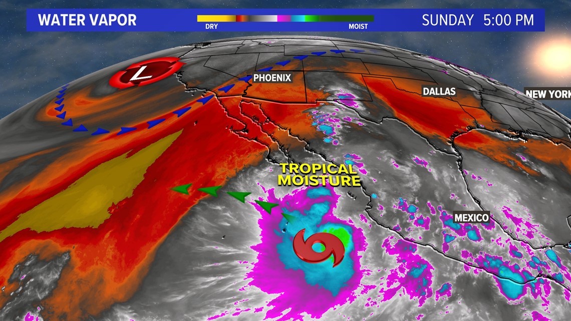
Low pressure and a deep trough will sit off the California coast through Thursday; this means we will have steady southwest winds feeding into Arizona.
At the moment, dry air is being funneled into the Desert Southwest, but Tropical Storm Madeline will be migrating to the west bringing tropical moisture into the mix.
>>> VERSIÓN EN ESPAÑOL: Tras una buena temporada de Monzón 2022, se viene el último empuje. Esto se espera en el tiempo esta semana
As Madeline drifts away from the Baja, her tropical moisture will feed into those southwest winds fueling our monsoon pattern for State 48.
This is expected to last through Thursday before the low-pressure center starts to migrate to our north and northeast.
All of this tropical moisture is expected to lead to scattered thunderstorms that will produce heavy downpours leading to flash flooding, especially in the eastern and northern High Country.
As low pressure and the deep trough lift out of the region on Friday, dry air will start to move in from the west bringing warmer, drier and sunnier weather back to the region.


Arizona Weather
Arizona has seen its fair share of severe weather. Here is a compilation of videos from various storms across the Grand Canyon state.


