PHOENIX — The Phoenix City Council has approved a possible light rail pathway that would extend the route further into the West Valley.
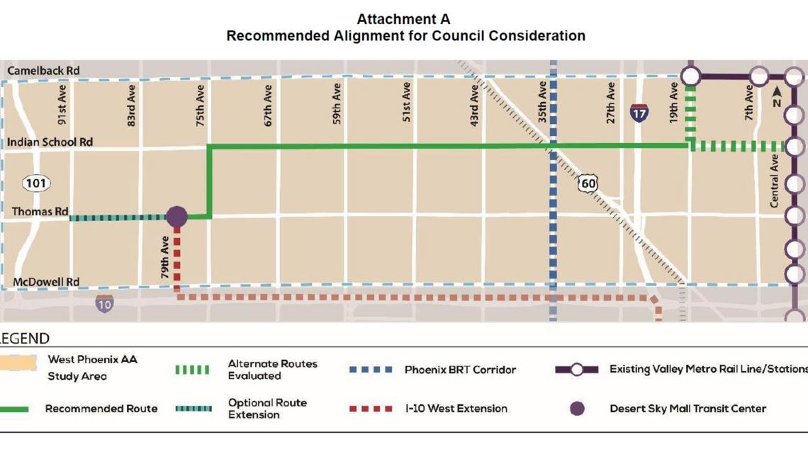
On Wednesday, the council reviewed a high-capacity transit route that could potentially bring the light rail service to Indian School Road. The alignment would move west to 75th Avenue, then move south to Thomas Road until it reaches the Desert Sky Mall Transit Center.
VERSIÓN EN ESPAÑOL: Hay una nueva propuesta para el tren ligero que recorrería el oeste de Phoenix
Mayor Kate Gallego said the western region of the city has "long awaited" for more high-capacity transit and Wednesday's action was a "step forward" in that direction.
City officials said the next step in the process would be to seek approval from the Valley Metro board and the Maricopa Association of Governments later this summer.
In 2022, the city and Valley Metro received a grant to help study how transit options could be improved in west Phoenix.
The analysis concluded that a light rail route in this location was "projected to generate the highest number of daily transit trips."
City records state that when the "project proceeds to the construction phase, Valley Metro and the City of Phoenix will need to enter into a separate funding agreement to advance the project."
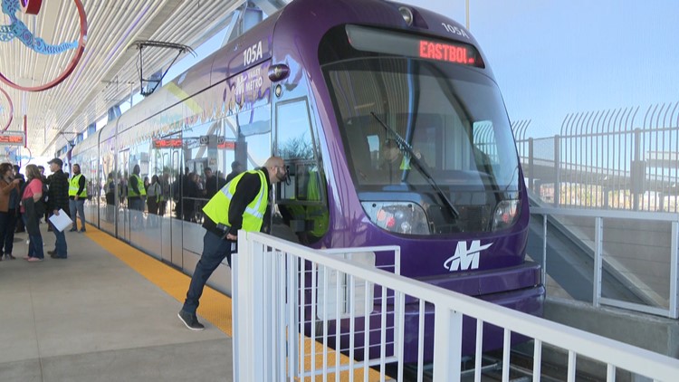
The existing light rail route can transport passengers from Castles N' Coasters in Phoenix to Gilbert Road in Mesa.
Earlier this year, Valley Metro finished adding three new light rail stations in the northwest region of Phoenix.

UP TO SPEED
How big is Maricopa County?
Maricopa County is the United States’ 4th largest county in terms of population with 4,485,414 people, according to the 2020 Census.
The county contains around 63% of Arizona’s population and is 9,224 square miles. That makes the county larger than seven U.S. states (Rhode Island, Delaware, Connecticut, Hawaii, New Jersey, Massachusetts and New Hampshire).
One of the largest park systems in the nation is also located in Maricopa County. The county has an estimated 120,000 acres of open space parks that includes hundreds of miles of trails, nature centers and campgrounds.
The county’s seat is located in Phoenix, which is also the state capital and the census-designated 5th most populous city in the United States.
The county was named after the Maricopa, or Piipaash, Native American Tribe.