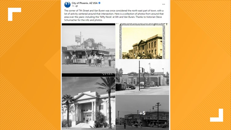
PHOENIX — The first things that come to mind when thinking about downtown Phoenix today may be towering buildings, the Footprint Center and ASU.
But decades earlier, the downtown area was known for things like full-service gas stations and "Nifty Nook Hamburgers."
Thanks to a Facebook post from the City of Phoenix, we get to jump back in time and see what life was like years ago.
The post was shared Tuesday morning and features several photos of the downtown Phoenix area near 7th and Van Buren streets. One of the photos even features several people hanging out at the "Nifty Nook." By the look of the photo, it was a popular spot.
According to the post, the information and photos were shared by historian Steve Schumacher.
Do you have any old photos of the Phoenix area? Share them with us on Facebook, Twitter and Instagram using the hashtag #BeOn12.
How big is Maricopa County?:
Maricopa County is the United States’ 4th largest county in terms of population with 4,485,414 people, according to the 2020 Census.
The county contains around 63% of Arizona’s population and is 9,224 square miles. That makes the county larger than seven U.S. states (Rhode Island, Delaware, Connecticut, Hawaii, New Jersey, Massachusetts and New Hampshire).
One of the largest park systems in the nation is also located in Maricopa County. The county has an estimated 120,000 acres of open space parks that includes hundreds of miles of trails, nature centers and campgrounds.
The county’s seat is located in Phoenix, which is also the state capital and the census-designated 5th most populous city in the United States.
The county was named after the Maricopa, or Piipaash, Native American Tribe.
12 News on YouTube
Catch up on the latest news and stories on the 12 News YouTube channel. Subscribe today.


