PAGE, Ariz. — The second-largest reservoir in the U.S. is continuing to dry up.
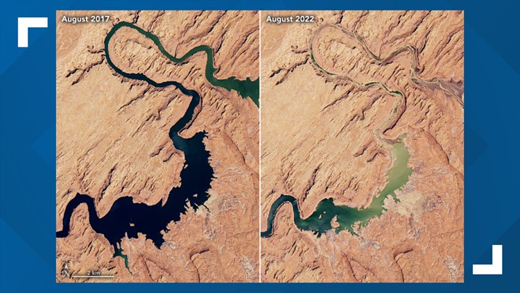
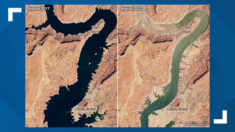
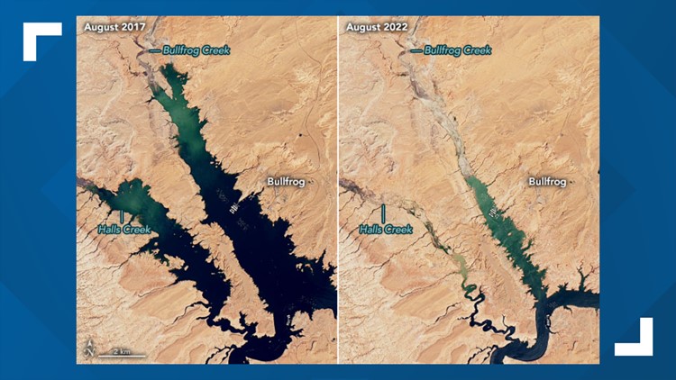
New NASA images show just how much Lake Powell has dried up over the past five years.
"On Aug. 22, the surface elevation was 3,533.3 feet, more than 166 feet below full pool," NASA said. "These natural-color Landsat images show the lake in summer 2017 vs. summer 2022."
The 2017 images were chosen by NASA because that was when the lake had the highest water levels in the past decade.
RELATED: 'Life beyond Lake Powell': Experts weigh draining Arizona's iconic lake amid worsening megadrought
NASA images show Lake Powell's dry-up over 5 years
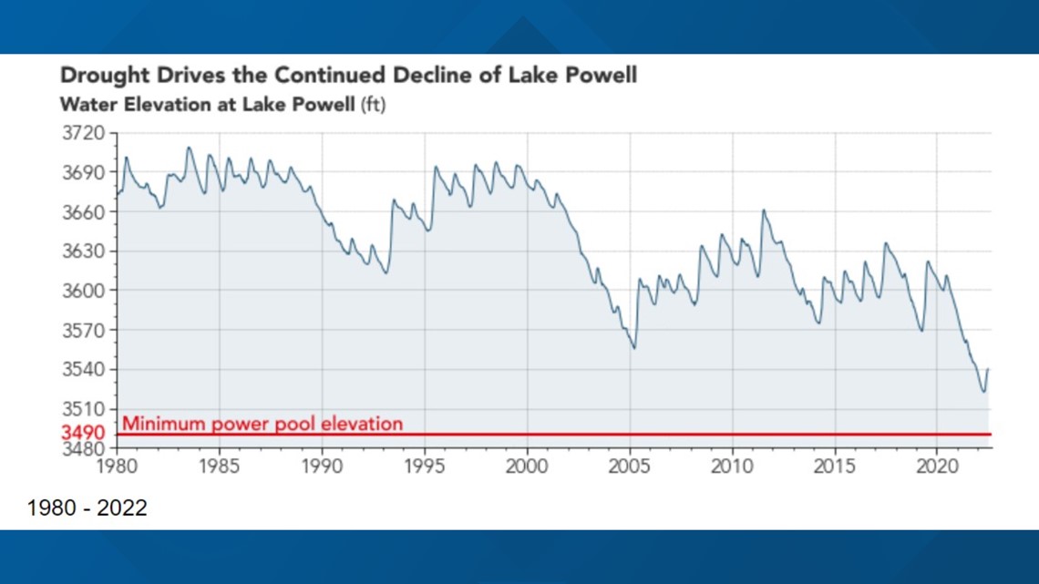
NASA also provided a graph showing how far the lake's water levels have dropped since 1980.
"The red line marks “minimum power pool elevation”; below that water level, hydroelectric turbines at the dam can no longer generate energy effectively," NASA said.


RELATED: A boat ramp at Lake Powell used to reach the water. There's now a 50-foot drop to the rocks below
Water Wars
Water levels are dwindling across the Southwest as the megadrought continues. Here's how Arizona and local communities are being affected.
More ways to get 12News
On your phone: Download the 12News app for the latest local breaking news straight to your phone.
On your streaming device: Download 12News+ to your streaming device
The free 12News+ app from 12News lets users stream live events — including daily newscasts like "Today in AZ" and "12 News" and our daily lifestyle program, "Arizona Midday"—on Roku and Amazon Fire TV.
12News+ showcases live video throughout the day for breaking news, local news, weather and even an occasional moment of Zen showcasing breathtaking sights from across Arizona.


