
It was an active afternoon Saturday as parts of the High Country experienced severe weather. According to the National Weather Service, strong thunderstorms from Paulden to south of Prescott created conditions for urban and small stream flooding until 3:45 p.m.
It was a different story for Phoenix. There were chances for scattered showers across the Valley, but no significant rainfall occurred as of the early afternoon.
The muggy weather in the Phoenix area will continue through the weekend as a few severe thunderstorms are possible.
According to the National Weather Service, the low in Phoenix this morning was 87 degrees.
The storm that hit Prescott began traveling south. Rain reached the northwest outskirts of the Valley around 3:30 p.m.
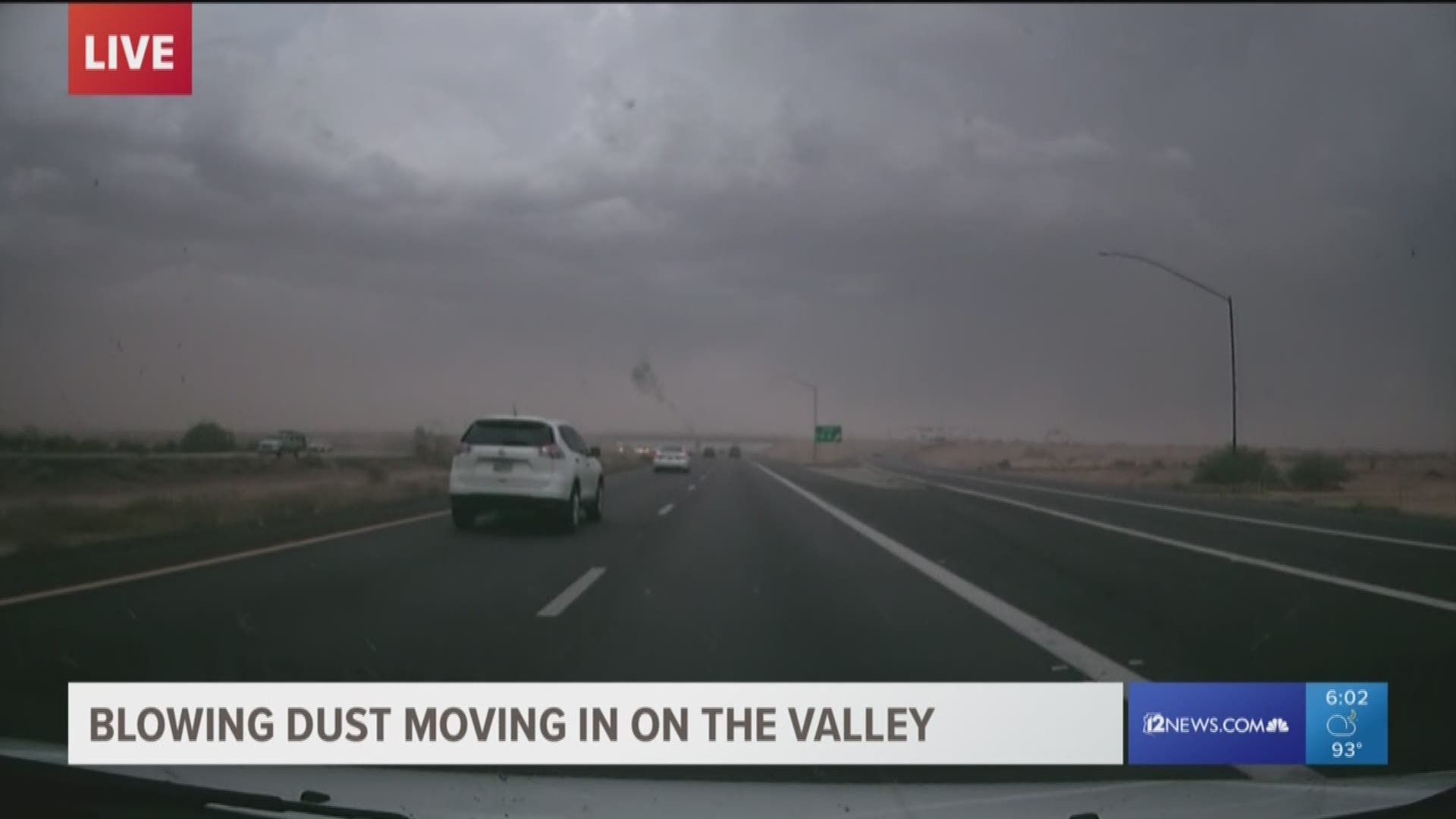
Heavy storms skipped the heart of the Valley Saturday afternoon, but northern parts of the Valley received measurable rainfall and the southern parts saw dust in the early evening.
After the dust storm, weather in the Valley was quiet.
Recall tips on lightning safety, flash flooding, and driving when a dust storm hits.
5:53 p.m.
ADOT tweeted a photo from one its cameras saying visibility is almost non-existent.
5:25 p.m.
NWS says a wall of dust is capable of producing visibility less than a mile and 30 mph winds along the I-10 on the southwest fringes of the Valley. The dust storm is crossing Highway 347 near Maricopa and heading towards I-8 and I-10.
A dust storm advisory is in effect until 6:30 p.m.
4:40 p.m.
NWS tweeted that there is a strong storm heading toward US 60 between Florence Junction and Superior. They say motorists should be prepared for 40 mph winds and torrential rain in the next 15-30 minutes.
3:50 p.m.
A strong storm is building rapidly over the White Tank Mountains, NWS tweeted. It appears to be heading toward the Buckeye area with 40-plus mph winds & torrential rainfall. NWS warns those traveling on I-10 to be prepared.
3:30 p.m.
Heavy rain is falling south of Wickenburg. The storm is complete with lightning and the rain has already caused some flooding. 12 News meteorologist Krystle Henderson says that storm could be heading toward Surprise.
1:45 p.m.
NWS tweeted that heavy rain and small hail made its way to the New River/Cave Creek area.
1 p.m.
NWS tweeted out a gauge measured 3.9" of rain at the head of Sycamore Creek.